Lidar sensors tend to be relatively expensive compared to other sensing technologies. The intricate design, the high-quality components, and the precision required for accurate measurements contribute to a higher price. Still, more and more automotive companies consider adopting Lidar sensors for their ADAS and Autonomous Driving platforms. A Lidar sensor can be bulky and heavy, especially the mechanical spinning or scanning Lidar types that require moving parts. This can be a limitation for applications where size and weight constraints are critical such as autonomous vehicles. Additonally, any mechanical systems is vulnerable to pyhsical srtress, like strong vibrations casued e.g., by bad road conditions. Although lidar sensors can provide highly accurate measurements, their effective range is often limited compared to other sensing technologies. For example, long-range Lidar sensors are available but tend to be significantly more expensive. In situations where long-distance sensing is required, such as highway monitoring or aerial mapping, this limited range can be a drawback. The vulnerability to weather conditions is a big drawback of Lidar systems. Adverse weather conditions such as rain, fog, or snow can interfere with lidar sensor performance. The laser beams can scatter or get absorbed by the particles in the air, leading to reduced accuracy or even complete failure in extreme cases. This vulnerability to weather limits the reliability of lidar in certain environments. Then. Lidar sensors can be sensitive to external light sources, particularly when operating in the visible spectrum. Bright sunlight or other intense light sources can interfere with the sensor readings and affect its performance and accuracy. Today’s Lidar sensors generate huge amounts of point cloud data that require significant computational power and processing time to convert into actionable information. Real-time processing of lidar data can be demanding, especially for applications that require quick decision-making or response times. Finally, the Lidar industry lacks standardization in terms of data formats and processing algorithms. Different lidar systems may generate data in various formats, making it challenging to integrate data from different sources or utilize off-the-shelf software tools. This lack of standardization impedes interoperability and increase engineering and development costs.
Mein lokaler Netzbetreiber hat mir den Anschluss einer 22kW Ladenstation (Wallbox) leider nicht genehmigt, da für meinen Standort lediglich ein maximaler Netzbezug von 11kW erlaubt sei.
Da ich bereits eine Photovoltaikanlage mit einer Spitzenleistung von 9.9 kW betreibe, möchte ich den maximalen Ladestrom der Wallbox dynamisch an die Energiegewinnung der PV-Anlage anpassen. Wenn die Photovoltaikanlage beispielsweise 5,6kW produziert, möchte ich der Wallbox elektronisch eine maximale Ladeleistung von 15.5kW zuweisen.
In diesem Beitrag möchte ich ein pragmatisches Lastmanagement vorstellen, das ich mit Hilfe eines Raspberry Pi Zero W Einplatinencomputer und etwas Peripherie umgesetzt habe.
Wechselrichter / PV Anlage
Mein Fronius Symo 10.0-3-M Hochleistungswechselrichter hat die Aufgabe, den von den Hanwha Q CELLS Q.Peak Solarmodulen produzierten Gleichstrom in Wechselstrom umzuwandeln und diesen ins Hausnetz einzuspeisen. Ein Fronius Smart Meter 63A dient zum effektiven Energiemanagement.
Wallbox
Als Ladestation habe ich mir die EVC04-AC22-T2P von Vestel entschieden, das diese ein gutes Preis-/Leistungsverhältnis für eine 22kW Wallbox (400 V AC, 3-phasig) hatte. Die EVC-04-AC22-T2P verfügt über einen potentialfreien Schaltkontakt (Ladevorgang ein/aus) und eine Modbus (RS485) Schnittstelle zur dynamischen Leistungsoptimierung.
Hardware
Raspberry Pi Zero W
DINrPlate DPZ1 Hautschienenhalter für Raspberry Pi Zero, grau
I have been working in the mapping and navigation business for more than three decades. I have seen companies disappearing as quickly as they came, and business that have survived since the beginning of digital maps.
However, the mapping business needs to run through a tough transformation process like e.g. the automotive industry.
The nature of digital maps has changed over the past years, and will even dramatically change over the coming years. The traditional map creation process is an expensive, laborious, time-consuming and last but not least, a slow-paced business domain that involves expensive equipment and high-skilled experts in geographic information systems.
The Dilemma of the mapping business
The traditional map creation process is overstressed with growing geographic coverages, steadily increasing number map features and their highly dynamic attributes. The underlying semi-automated or even manual production processes can’t cope with the amount and frequency of incoming data sources. It’s like in an old manufactory – productivity is mainly limited by the number of workers.
In my opinion, it is time to stop billions of investment in these outdated mapping technologies that produce large static databases, which are already outdated after release.
Ways out of this dilemma
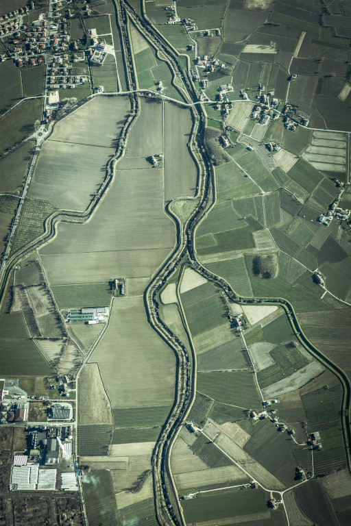
Today, we have the essential hardware and software technologies in place in order to replace most of the traditional semi-automated map creation methods. Powerful cloud computing resources running machine learning and geospatial conflation algorithms can help producing vector maps from different source, tailored for navigation systems, advanced driver assistance systems, or automated driving use cases. Aerial images captured from drones, sensor data surveilled by large vehicle fleets and a steadily growing community of volunteering mappers are able to substitute large portions of geospatial data the big mapping companies own today.
This said, we have to ask ourselves the question “Who should own this dataset”, or more provocatively, “Why should anyone own THE map of the world”. Since digital maps are so critical to many industries, why shouldn’t we copy the well-known success stories of the open source software domain? Just think of Linux, Android, Apache, WordPress, Hadoop, Kubernetes, Docker, Wikipedia, OpenStreetMap, and many other not mentioned. There are many viable and proficient business cases even though that you give away source code or raw data for free.
Many people love Google Maps, and the Services built around this valuable top asset. Yes, I call it a Service, not a data source. Google Maps is a truly closed system because Google does not disclose or even license their underlying map data, unlike companies like HERE or TomTom.
For a second this does not feel critical at all, right? However, by hiding the actual data you can’t tell for sure whether you see a “true” map or not. Imagine there was a restaurant not visible (or searchable) in Google Maps. One could think that this particular restaurant does not exist, right? But what if Google makes this decision for you, e.g. in favor of a paying advertising customer, for political reasons, due to legal regulations, or just because of simple commercial interest? You think this is too much “1984”? Not at all. Look at the People’s Republic of China where today we have a strictly censored and regulated street map.
Different Business Models
Open data (like HERE or TomTom provide) means that you can have a look at the fundamental data set – it doesn’t necessarily mean the data is freely available, like OpenStreetMap is. These companies make their money by licensing their datasets. OpenStreetMap has millions of active contributors (mappers) who incrementally improve and enrich the OSM map. Well, Google does the same thing with an interesting detail: they don’t share their the data users contribute. Any crowd-contributed ratings, open hours, map attributes, pictures, movement patterns, and many other data sets become part of Google’s closed data universe. Surprisingly, people do this on a voluntary basis, not caring about privacy data protection at all. In contrast to HERE or Tomtom Google Maps makes money with their services, not by selling the actual data (they get from you for free).
Being a mapper
Well, I have been actively following the OpenStreetMap project from its beginning in 2005 since I was curious whether the idea of a crowd-based mapping initiative can work. I am part of this mapping community as well. Many years ago, I spend weeks in digitizing the entire city I live in by mapping roads, lanes, streets, buildings, house numbers, point of interests and many other features. In my company, we contributed buildings and house numbers for the entire city of Vancouver, Canada. This all said I truly believe in community-based map production.
I strongly believe that OpenStreetMap is (or soon will be) a major rival to Google Maps, at least when it comes to data sourcing.
Corporate Contributions
Large companies like Amazon Logistics, Apple, Facebook, Grab, Microsoft, Uber, Tesla and many other invest in OpenStreetMap by corporate contribution. Over the past few years, these companies edited nearly a fifth of the road network.
In order to use OpenStreetMap database as an alternative source for professional navigation services both the quality and coverage of routing attributes (e.g. turn restrictions, lane information, road topology) need to be improved significantly. Quite wealthy companies like Grab, Tesla and Uber committed many million commits of this kind over the past 2 years. In addition, addresses and house numbers were committed in large amounts as well. Tesla captured and contributed information in context of parking isles, lots and spaces. In terms of usability, these edits help both the mentioned companies, as well as the OSM community.
We find these extremely successful and wealthy companies collaborating and contributing to OpenStreetMap on a very high scale. They wouldn’t do so if there no interesting business case in it. But the best thing ist that OpenStreetMap would survive and continue being successful without any of the companies mentioned.
Fleet-based Mapping
Imagine the contribution power of smart vehicle fleets equipped with embedded physical sensors capturing road infrastructure and processing photo imagery. Usually cars follow traffic rules and road topology – adding these attributes to OSM would be a piece of cake. In combination with artificial intelligence and machine learning algorithms, even small sized fleets can digest raw sensor data to enrich and conflate maps in the backend.
Looking at the consumer devices industry: Apple recently has added LiDAR to its new line of iPhones and iPods allowing users to scan the world in high fidelity. So soon we will have smartphones in our hands able to capture our 3D enviornment and help creating maps for (hopefully) everybody.
I’m sure that a hybrid multimodal delivery chain can bridge long distance gaps current cargo drones have. Hybrid delivery has the potential to provide substantial cost & time savings, especially in suburban areas.
Intermodal cargo transportation can overcome the road traffic based uncertainty of the delivery process. And it helps reducing pollution and emissions, especially in urban and suburban areas.
Interview hosted by photographer, visual artist, painter, and movie maker Joakim Lloyd Raboff.
In order to hear the full interview visit this TerraNet podcast on SoundCloud.
Image provided by Joakim Lloyd Raboff
The automotive industry is in the midst of massive transformation with its change to electrical and autonomous cars. Not since the replacement of the horse and introduction of the combustion engine, more than 100 years ago, has the car industry been at such an inflection point.
A wholesale shift to autonomous and electric vehicles will not just reshape the entire transportation industry, but also our daily lives. Zero crashes, zero fatalities, and zero emissions were once utopian visions. Presumably, future cars will become smart enough to avoid all collisions, eliminating over 1.35 million traffic fatalities around the world each year.
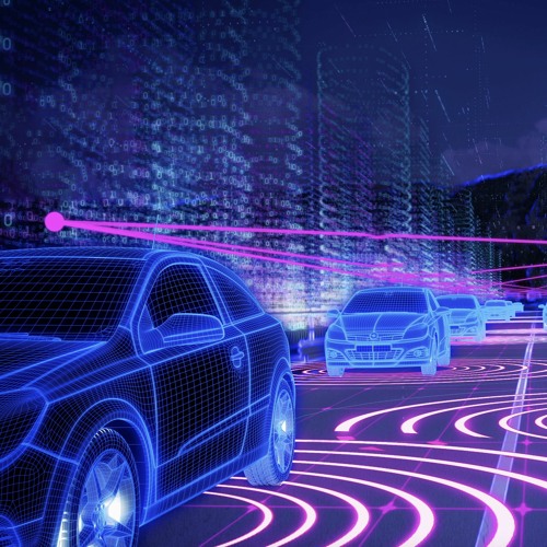
Artificial intelligence (AI) such as deep neural networks is being applied worldwide in the automotive market to fields like computer vision, natural language processing, sensor fusion, object recognition and autonomous driving projects.
Nihat:
Well, since the beginning of the automotive era in 1886 – that was 134 years ago when Daimler and Benz invented the first automobile – we face crashes, fatalities and emissions caused by these machines.
More and more car manufactures put Advanced Driver Assistance Systems into their new models, which help significantly to improve safety, like Collision Warning, Active Break and Emergency Stop Assist, Adaptive Cruise Control (Mercedes-Benz DISTRONIC), Lane Keep/Change Assist, Blind Spot Assist Active Speed Limiters, Night Vision, and may systems that are more helpful. However, we need to become better on the Pedestrian Detection side.
In order to make our road traffic safer we need to teach cars how to drive autonomously, reliably and safely. Software has the potential to drive safer than human beings do. We are not saying that all accidents are preventable.
While driving millions of miles, a bunch of various vehicle sensors capture the real world to create a high definition map, for both self-driving and navigation. The more data we gather the more we feed our data-hungry learning algorithms that become incrementally better and better. Self-driving cars can give us more quality-time, can make us feel like in a second home.
However, the true potential of self-driving cars will be become visible in a smart combination with other transportation modes: bicycles, taxis, transit, trains, pods, and so on.
Joakim:
The Third Global Ministerial Conference on Road Safety was held on 19 and 20 February 2020 in Stockholm, and resulted in the “Stockholm Declaration,” a list of 18 resolutions linking road safety to sustainable development with the aim to achieve global goals by 2030. The agreement is meant to halve the number of traffic deaths by 2030.
The Stockholm Declaration also emphasized the need for new vehicle technologies.
Alongside decrease of velocity, what do you envision as the single most important item needed to be implemented on the technology side in order to achieve this vision?
Nihat:
In the context of COVID-19 Corono Virus deaths I have been looking into road traffic fatalities of the past years. So, I remember these numbers, at least for Germany.
We human beings do make mistakes, and probably always will do. Luckily, we learn by trial and error. We learn faster the stronger the impact of a specific mistake is, right? However, nobody wants these “strong impacts” on our roads. Technology can help us avoid – or at least ease – fatal impacts caused by motorized vehicles. And it’s not just a matter of velocity – otherwise Germany was at the top of the statistics.
Although the number of motor vehicles increased from 250.000 vehicles back in 1970 to almost 2 billion vehicles today (factor 8.000) , in these 50 years the average number of vehicle-related deaths even decreased from 1 death per 300.000 km down to 1 death per 800.000 km.
Roughly, 50% of the road traffic deaths happen to drivers or passengers of 4-wheeled vehicles, motorbikes and bicycles have a share of 18%. Shockingly, almost a third of all road fatalities happen to pedestrians, the most vulnerable road users. This where we have to become better. Here, I think TerraNet’s VoxelFlow can drive a paradigm shift.
Still, it will be a big challenge to halve the traffic deaths by 2030, and for Germany, this would require a yearly decrease by 7%. Unfortunately, the current decline is only about 3%. As professor Christensen said, its still hard to understand the intend of cars, especially the one that don’t communicate car2car, or car2infrastructure.
Joakim:
In the World Economic Forum’s recently published report on “The Future of the Last-Mile Ecosystem,” they anticipated that demand for e-commerce delivery will result in 36% more delivery vehicles in inner cities by 2030. The COVID-19 pandemic has put an incredible strain on global supply chains, from medical supplies to household goods, as spikes in demand stress-test logistics infrastructures. There should an opportunity for autonomous and unmanned delivery vehicles to assist in addressing this demand and help to reduce the risk of spreading infection.
How do you see technology spurring this development and increasing preparedness to accept this or similar extraordinary and abnormal situation as the new normal?
Nihat:
Earlier I was saying that we need to highlight the benefits and disadvantages of different transportation modes. For example, mass transit is not the best transportation in case of a pandemic situation, but cars are, right. Having Smog in the icty
Yes, it’s a fact that more and more people shop online, which of course increases urban traffic caused by traditional delivery trucks. Worldwide we see yearly increases by 8% to 10%. I don’t think we will manage to compensate this steady rise by conventional ground transportation.
Back in 2008 we at Daimler started our biz transformation process from manufacturing and selling cars, vans, busses and trucks to being a mobility company. We started new business units for car sharing (cargo) and mobility services (like moovel) integrating the public transportation sector in order to reduce urban traffic and emissions, and last but not least increase life quality and quality time. With StarShip we invested in urban delivery robots and cargo vans – which reflects an innovative multimodal transportation chain.
But as you said Joakim, it’s time to conquer the urban airspace by developing smart, autonomous, collaborative, collision-free, solar or hydrogen powered cargo drones. These drones could pick-up packages from – or drop them on – moving trucks, relay them airborne to other drones, to autonomous ground robots, parcel locks or distribution centers. This way we could master the last mile delivery, even dropping packages directly on your balcony. Our Daimler project Volocopter successfully made first steps towards manned air taxis. You might know what the meaning of the 3-pointed Mercedes-Benz star: it represents our drive towards universal motorization: dominating the land, sea, and air (three points).
Social distancing works best by letting intelligent robots into our work, home and mobility domain by integrating them seamlessly into all transportation chains.
There are only a handful of experts who dare to say that we do not need HD maps to cope with autonomous driving. I count myself among this small group, and believe that high definition maps contradict the idea of fully automated driving.
HD maps contain many useful features modelling the real world, much better and more accurate than navigation maps do today. The road geometry, carriageways, road lanes, dividers, bridges, tunnels, traffic lights and signs, crosswalks, sidewalks and many other features are stored in a geospatial database on cm-level. However, the time an HD map database is shipped or streamed, it’s already outdated. I agree that HD maps are useful to look around the corner, ahead of the visual horizon, like an additional virtual sensor. Since there will be no error-free HD map database there will be no 100% confidence in the contained map features and attributed
One of the most significant reasons why I think that HD maps will disappear sooner or later is that autonomous driving must learn to deal with a constantly and frequently changing roadside elements, road users and traffic situations, as we human driver need to. Providing a real-time, high-accurate, high-detail, complete and error-free map that reflects the real-world is utopia. Instead of relying on data extracted from a geospatial database driving algorithms need to carefully observe and predict the vehicle and its environment, especially other road users.
Of course, this requires exceptional onboard computing power embedded into silicon. Neural networks are data hungry and require billions of kilometers of training data in order to reach error-free driving in all conceivable situations.
Yes, there was a time where there was no usable artificial intelligence, no deep learning, and not enough computational power and storage to train computers to drive autonomously.
As cars become increasingly software-driven, non-automotive companies gradually start viable claims on the driver’s seat. Of course, automakers fear should they lose their customers to software giants cars might become somehow commodity devices defined (and ruled) by software. If the automotive industry doesn’t toughen up their vehicle platforms to serve social media, enable locations based services and adopt the Internet of Things, the big software and Internet players will conquer and eventually dominate the automotive ecosystem.
Location-aware mobile services allow vehicles and drivers to share detected events; incidents and location over social media channels in real-time. Each individual who shares location-based data contributes to a richer, more accurate and real-time digital map of the world. Vehicles must no longer be part of an isolated digital ecosystem (embedded era) and need to be fully integrated into the everyday-lives of consumers (mobility era). Cars are extremely powerful and helpful sensors when it comes to real-time capturing our mobility world.
The potential data the automotive industry neglects and ignores today is much more valuable than they thought. The value of fully connected vehicles will be defined by the amount of collected data and the number of software apps utilizing an open and standardized automotive platform. Over time the (still new) relationship between automakers and software providers will show interesting symptoms of an ongoing transformation process.
This website uses cookies to improve your experience. We'll assume you're ok with this, but you can opt-out if you wish. Cookie settingsACCEPT
Privacy & Cookies Policy
Privacy Overview
This website uses cookies to improve your experience while you navigate through the website. Out of these, the cookies that are categorized as necessary are stored on your browser as they are essential for the working of basic functionalities of the website. We also use third-party cookies that help us analyze and understand how you use this website. These cookies will be stored in your browser only with your consent. You also have the option to opt-out of these cookies. But opting out of some of these cookies may affect your browsing experience.
Necessary cookies are absolutely essential for the website to function properly. This category only includes cookies that ensures basic functionalities and security features of the website. These cookies do not store any personal information.
Any cookies that may not be particularly necessary for the website to function and is used specifically to collect user personal data via analytics, ads, other embedded contents are termed as non-necessary cookies. It is mandatory to procure user consent prior to running these cookies on your website.